Nanjing Road Start and End Points Explained
you’re wondering where Nanjing Road begins and finishes? I’ve walked the whole thing myself, more than once. So here’s the deal: Nanjing Road is a main street running east-west across Shanghai. The famous shopping part you hear about, the pedestrian street, officially kicks off where it meets The Bund (that’s Zhongshan Dong Yi Road) on the east side. It wraps up over at the crossing with Xizang Road (Tibet Road) to the west. But the road itself doesn’t stop there. It keeps going west as a regular street for cars, all the way past Jing’an Temple and further.
Table of Content

Defining the Physical and Historical Span
The Official Eastern and Western Termini
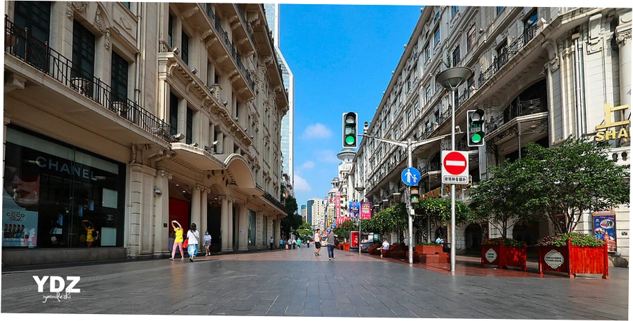
where does Nanjing Road start and end? Most people are asking about the famous Pedestrian Street, and its start and finish are well marked. You’ll find the eastern end at The Bund.
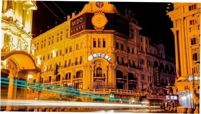
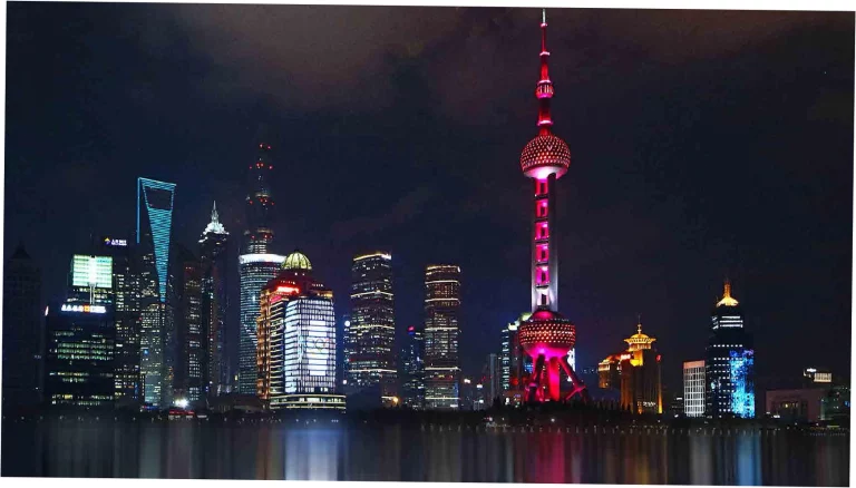
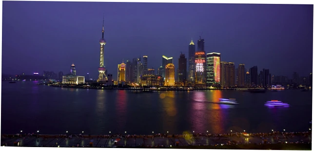
marked by a famous bronze statue where East Nanjing Road hits Zhongshan Dong Yi Road. From there, you get an amazing view of the Huangpu River and the Pudong skyscrapers. I always tell newcomers to start their walk right there for the best experience.
The western end is simpler, just a clear sign at Xizang Road where the walking area ends and cars begin.
Now, about the history and why it’s split into East and West. Lots of folks search for the history of Nanjing Road’s endpoints, wanting to know more. Historically, Xizang Road was the dividing line.
East Nanjing Road was part of the International Settlement, while West Nanjing Road belonged to the French Concession. That old 19th-century split still shapes the road’s feel today. That’s why the architecture and shops feel so different as you walk from one end to the other.
| Part of the Road | Where it Starts | Where it Ends | Main Vibe Key Spots | Rough Length |
|---|---|---|---|---|
| Nanjing Road Pedestrian Street | At The Bund (Zhongshan Dong Yi Road) | At Xizang Road (Tibet Road) | Just for walking, tons of shops, old buildings, and lots of tourists. | About 1.2 kilometers long. |
| East Nanjing Road (with cars) | The Bund | Xizang Road | Continues from the walking street, but cars are allowed, has a mix of stuff. | About 1.2 kilometers long. |
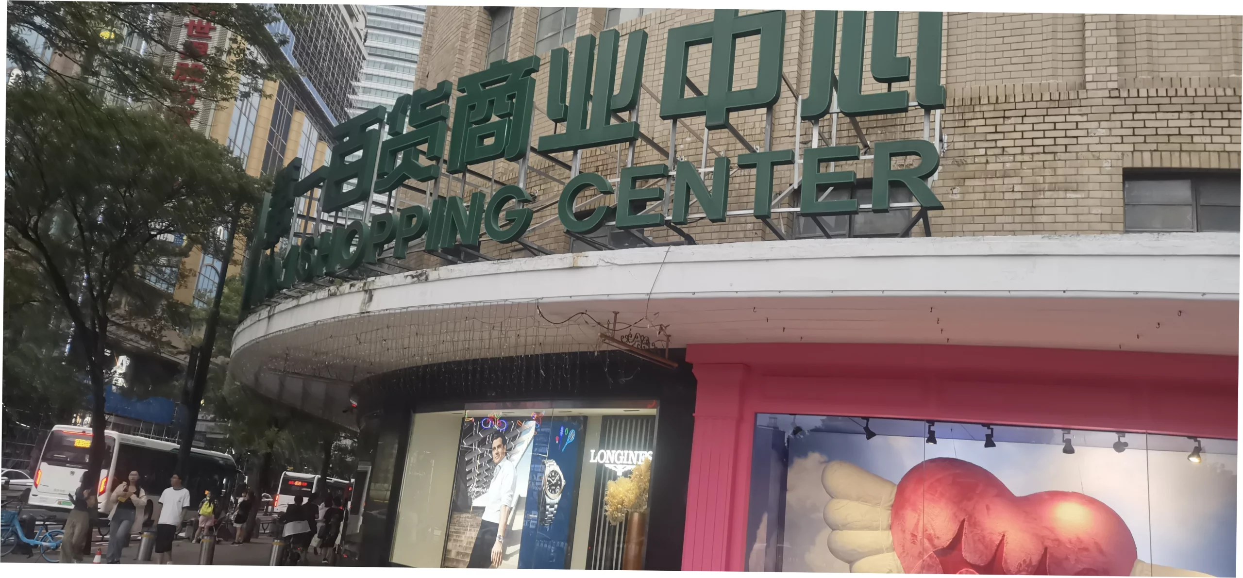
| West Nanjing Road (Main Part) | Xizang Road | Shanghai Center or Jing’an Temple | Fancy malls, hotels, office buildings, and some cultural spots. | Roughly 2.8 km. |
| West Nanjing Road (Further Out) | Jing’an Temple | Yan’an West Road | More of a mix of homes and local businesses. | ~3 km |
Comparing Nanjing Road to Other Major City Avenues
Shanghai’s Artery vs. Global Counterparts
People often compare Nanjing Road to other famous streets, like checking if it’s longer than Fifth Avenue or Oxford Street. where does Nanjing Road start and end? Its main shopping part runs from The Bund to Jing’an, about 5 to 6 kilometers long.
It’s shorter than some other famous avenues, but it’s packed with shops. Unlike a straightforward street, it changes as you walk. You start near The Bund with touristy souvenir spots, and by the time you get near Plaza 66 at the Jing’an end, you’ll see high-end luxury stores.
Now, if you’re a tourist trying to choose between Nanjing Road and Huaihai Road for shopping, here’s the deal. Nanjing Road is wider, noisier, and full of big sights. It’s great for first-timers and families.
Huaihai Road, on the other hand, feels more stylish and polished, with lots of trees. Where you start on Nanjing Road makes a big difference too. If you begin at The Bund, you’re thrown right into the tourist buzz. But if you start from the Jing’an end, you get a slower, fancier start to the street.
Planning Your Visit: Scenarios and Decision Paths
For First-Time Tourists and Family Groups
Figuring out where to start your walk on Nanjing Road is a classic question. Should you begin at The Bund or Jing’an Temple? Well, it really depends on what you’ve got planned for the day.
If you want to include views of the Huangpu River, then definitely kick things off at The Bund. But if your day is all about shopping and you plan to end with dinner in Jing’an, it’s better to start at Xizang Road and head west.
Personally, I’m a fan of starting at The Bund. The moment you see that neon-lit pedestrian street unfold is something you won’t forget. You can track your walk using key landmarks. Look out for the No.1 Department Store about halfway, and the Shanghai Museum of Contemporary Art is near the west end.
Now, let’s talk about getting there. Knowing the closest metro stations is key. You’ll probably search for things like closest metro to the start of Nanjing Road or where to get off for the west end.
For the east end of Nanjing Road, hop off at East Nanjing Road Station on Line 2 or 10, and use Exit 7. To reach the west end of the main pedestrian bit, your stop is Finish up at People’s Square. Station, which several lines go to.
And if you’re aiming for the very western end, right by Jing’an Temple, get off at Jing’an Temple Station on Line 2 or 7. Knowing these metro stops really helps you break your walk down into manageable parts.
| What’s your main goal? | Where you should start | Where you should aim to end | The big pluses | Things to watch out for |
|---|---|---|---|---|
| If you want the classic tourist photo experience | Start at The Bund, which is the eastern end. | Finish up at People’s Square. | You get those iconic river views right away, perfect shots of the classic neon signs, and the energy is super high. | But it’s the most crowded part to start, and the first stretch is packed with souvenir shops. |
| If you’re all about serious shopping, especially luxury stuff | Begin in the Jing’an Temple area, over in the west. | Then walk east towards Xizang Road. | You can hit luxury malls like Plaza 66 first, then find more variety as you go. It’s also less crowded at the start. | The downside is you miss that dramatic wow moment you get starting at The Bund. |
| If you’re short on time but want the highlights | Finish up at People’s Square. (Middle) | From there, you can choose to walk east towards The Bund or west towards Jing’an. | It’s a central spot, close to museums, and you can pick your direction depending on what you have time for or what interests you. | You won’t get the feeling of the full, straight journey though, so it might feel a bit broken up. |
| For evening lights and nightlife | Head to The Bund around dusk. | Then walk west, heading towards the bars on Nanjing West Road. | You’ll see the street transform from day to a neon-lit night, and you can finish at some lively places to eat or drink. | Just know some shops might close earlier, and the crowd changes from shoppers to people out for dinner and drinks. |

Common Misconceptions and Navigation Risks
Addressing Confusion and Overcrowding
The two Nanjing Roads misconception: A frequent source of confusion, leading to searches like is Nanjing Road one long street or separate and why does my map show Nanjing Road far from The Bund.
The core issue is that Nanjing Road is a continuous road, but its famous pedestrian section is only a part. The road extends over 10 km west past Jing’an.
Visitors expecting pedestrian zones all the way to Jing’an Temple will be disappointed and potentially unsafe when encountering traffic after Xizang Road.
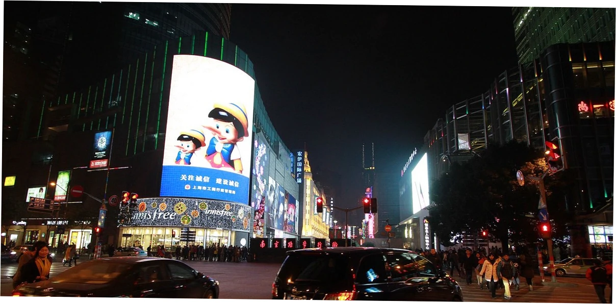
Crowd management and timing risks: Searches such as best time to walk Nanjing Road to avoid crowds and is Nanjing Road safe at night near the ends indicate risk assessment. The eastern terminus at The Bund is perennially packed.
visiting early on a weekday morning offers a rare moment of calm. The western end near Jing’an has vehicle traffic, so pedestrians must use crosswalks carefully. During holidays, the entire pedestrian section can reach unsafe densities, making the ends critical choke points.
Beyond the Basics: Historical and Urban Development Context.
How the Endpoints Shaped and Were Shaped by the City
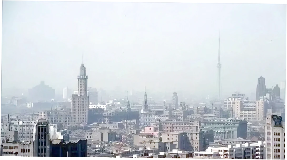
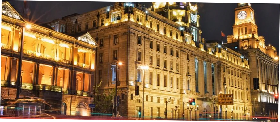
Take The Bund, it’s like a symbolic starting gate now. But this eastern starting point wasn’t always so glamorous. Back in history, The Bund was just the working waterfront for the International Settlement.
As Nanjing Road grew into a major shopping street, it changed this endpoint. It became a symbolic gateway, linking the old colonial financial center with the Chinese business district.
That’s why if you search for the original start of Nanjing Road in the 1800s, you’ll see different maps. The meaning of the road and where it starts and ends have kept changing as the city spread west.
Now, Jing’an Temple is like a modern anchor in the west. It’s not the official end of the road, but in people’s minds, it’s the real cultural and shopping hub marking the western end.
When people ask about urban development, like Nanjing Road future extension plans, they’re usually talking about this growth to the west. Building Plaza 66 and Kerry Centre really locked in this area as the final stop for high-end shopping. For shoppers, it feels like the natural end, even though the road for cars keeps going.
| Here’s the timeline. | This shows where Nanjing Road started on the east. | And this is where it ended on the west. | It tells you what the road was famous for back then. | You can also see how people got around on it. |
|---|---|---|---|---|
| Back in the late 1800s, when it was just getting started, | the road began at The Bund, right by the Huangpu River wharves. | It stretched out to about Xizang Road, which was pretty much the edge of town. | It was a main street for selling foreign goods, with some early department stores popping up. | People used horse-drawn carriages and rickshaws to get around. |
| Then came its golden age in the early to mid-1900s. | The eastern end was still The Bund, but now it was full of big bank headquarters. | Out west, it reached all the way to Jing’an Temple, marking the suburban boundary. | This was China’s number one street, buzzing with shopping and fun things to do. | You’d see trams, cars, and lots of people walking. |
| After reforms in the late 1900s, things changed again. | The Bund at the east end became a major spot for tourists to take photos. | On the west, it ended around the Shanghai Center, where the Portman Hotel is. | Nanjing Road came back as a top shopping street and a must-visit for tourists. | Buses and taxis were common, and the sidewalks were packed with people. |
| Now, in the 21st century, here’s how it looks. | The start at The Bund is that iconic photo spot everyone knows. | And the western end is around fancy places like Plaza 66 and the Jing’an Kerry Centre. | So the road has two personalities now: the east is for the tourist crowds, the west is for high-end shopping. | People use the metro, ride-hailing apps, and big parts are just for walking. |
Now, let’s get practical and plan your visit with some local tips.
From Search Query to On-the-Ground Experience
Want to walk it? Here’s a simple plan for a half or full day. Kick off at Exit 7 of East Nanjing Road Metro. Walk the whole pedestrian section to Xizang Road. That’s about 30 to 45 minutes, more if you stop to look around.
Cross at the traffic light, then keep going on West Nanjing Road all the way to Jing’an Temple. That’s another 45 minutes to an hour of walking. I’d suggest taking a break in the middle.
Grab a snack at a historic spot like the First Food Hall. This way, you see the famous start, the middle part, and the modern end point.
What about the side streets? Savvy searchers often ask how to dodge the crowds or find cool alleys off the main road. Knowing where the road starts and ends is great because those spots are perfect for exploring the areas right next to them.
Near the east end, just duck into the side streets heading towards Jiangxi Road. You’ll find loads of local places to eat. And near the west end, check out the alleys north of West Nanjing Road, around Zhangyuan.
They have well-preserved Shikumen buildings. This changes your simple search into a much richer exploration of Shanghai.
All set to plan your perfect walk? I made some detailed, printable guides. They break down the whole trip from The Bund to Jing’an Temple. They’re sorted by how much time you have, what you like, and your energy.
Plus, they include hidden spots most tourists never see. Just click here to get your free guide. Turn your search into a smooth Shanghai adventure.
FAQ: Nanjing Road Start, End, and Navigation
Is the entire Nanjing Road from The Bund to Jing’an Temple a pedestrian street?
No, this is a very common misconception. Only the section from The Bund to Xizang Road (Tibet Road) is the official Nanjing Road Pedestrian Street. Once you cross Xizang Road heading west.
it becomes a regular vehicular road (West Nanjing Road) with sidewalks. You can walk all the way to Jing’an Temple on these sidewalks, but you must obey traffic signals. The pedestrian zone is about 1.2 km long, while the full walk to Jing’an is closer to 4 km.

Which end of Nanjing Road is better for luxury shopping: The Bund end or Jing’an end?
Definitely the Jing’an Temple (western) end. While the eastern pedestrian section has large flagship stores for major brands (like Nike, Samsung), the truly high-end luxury malls (Plaza 66, Reel Mall.
Jing’an Kerry Centre) are concentrated on West Nanjing Road near the Jing’an Temple area. If your goal is window-shopping or buying luxury goods, start your journey at the Jing’an end and work your way east.
I’m staying near People’s Square. Should I walk east to The Bund or west to Jing’an first?
From People’s Square, I recommend walking east to The Bund first. This direction allows you to experience the climax of the iconic river view. The walk from People’s Square to The Bund is shorter (about 10-15 minutes).
and you can then take your time walking back west through the pedestrian zone, exploring side streets, and continuing to Jing’an if you wish. It creates a more narratively satisfying journey, ending at either the modern skyscrapers of Jing’an or back at your starting point.
What’s the biggest mistake tourists make regarding Nanjing Road’s layout?
The biggest mistake is assuming the famous, crowded pedestrian experience continues all the way to Jing’an Temple. Many tourists start at The Bund with the goal of walking to the temple, not realizing that after about 20-30 minutes.
the pedestrian mall ends at Xizang Road. They are then faced with several more kilometers of city sidewalk walking alongside traffic, which can be tiring and less scenic. Always plan your energy and time knowing the pedestrian section is only a portion of the full length.
Are there any risks or safety concerns at the start/end points, especially at night?
The biggest worries are about the crowds and traffic, not crime. Where Nanjing Road starts at The Bund, it’s packed all the time. Watch out for pickpockets in those tight crowds.
Down at the western end of the walkway, near Xizang Road, things change fast. You suddenly hit busy traffic, so you gotta pay attention. Always cross at the crosswalk. The spots themselves are well-lit and have plenty of police around.
It gets riskier on big holidays. The crowds at these start and end points of Nanjing Road can get totally overwhelming.
How has the western endpoint of Nanjing Road changed in the last 20 years?
Dramatically. Twenty years ago, the area around Jing’an Temple was developed but not the ultra-luxury hub it is today. The completion of landmarks like Plaza 66 (2001), the renovation of Jing’an Temple itself.
and the opening of the Kerry Centre complex solidified West Nanjing Road’s role as the modern, upscale terminus of the shopping corridor. This development has effectively created a new western endpoint in the public’s mind, shifting focus from the older commercial area around Shanghai Center further east.
For a history buff, is it worth walking the entire length from river to temple?
For sure, but you should plan it out. The cool history part is seeing all the different layers. Kick off at The Bund, where Nanjing Road starts. You’ll see the old colonial-era financial beginnings.
Walking west, you go through a timeline of buildings. On East Nanjing Road, there are structures from the 1920s and 30s. Near People’s Square, you find socialist-era department stores. Finally, you hit the postmodern skyscrapers in Jing’an.
The whole road is basically a timeline showing how Shanghai grew. My advice? Do it in chunks with breaks. That way you can really take in the history, instead of just doing one long slog.
Seeing how the buildings and shops change from where Nanjing Road starts to where it ends tells you the whole story of modern Shanghai.